Misty Meadows Vernal Pool Project
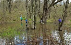
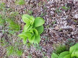
Site Identification: Located approximately 2 kilometres from the main campus of Westford School, a vernal pool was chosen for an extended investigation. This location was chosen after the area had been observed through three seasons of weekly visits by the "Shackletons" - a group of educators using the town trails throughout the fall, winter and spring months. This image is looking northwesterly at the terminus of the zone student-named "Drizzle cake" (suggested after walking back to the school in a drizzling-mist following a two-hour research visit. Notice the upslope. A May visit by 8th-graders revealed a small pool at the top of this hill feeding water into our pool. The entire pool areas (3) is approximately thirty metres long and separated laterally by a small upswell of a land spit. This area is sometimes submerged but is more typically above the line providing a convenient place to set sampling materials. Access from this high point gives access to all three "zones" of the larger pool. Along with "Drizzle Cake", the other areas were student- named as "Pot Belly"(so-called due to its deeply-submerged centre,) and "Enchilada" (I have no idea how this came to be!)
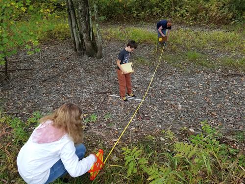
Training: A gully located behind the middle school area provided convenient training for transect measurement protocols used to define the submerged geography of any body of water. This same technique is used to define the geography of the Browns River when B.M.I. assessment takes place in the fall. The technique requires a three-person team to coordinate placement of measuring stick, depth readings and accurate recording of data. This important work gives valuable training in team-based research.
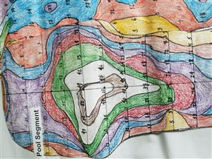
Getting Started: The first step to the project was to better know the geography of this area. Groups of seventh and eighth-grade classes made multiple visits to measure this. Using transects a metre apart, depths of the vernal pool were assessed when all moisture was absent from the pool areas. Researchers found that soil colouration provided reliable pool-edge locations. Using survey string stretched across the pool areas, "depth" measurements every fifty centimetres. Measurements were called out and recorded by data-takers. Hundreds of measurements provided a detailed map of the pool areas when the water returned in the late fall. Student-researchers decided to divide the total pool area into three portions. These were named "Pot-Belly," "Drizzle-Cake" and "Enchilada." The significance of depth relates to temperature and species diversity based on a need for sunlight, specific temperature, or pool bank flora support. When researchers returned in the springtime, they could now cross-reference species location and identification with pool geography. Repeating this process over a series of springs would establish a pattern of species preferences for incubation and habitation.
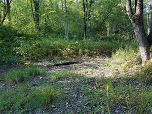
Pot Belly Zone: the shallows meander northward though with some overgrowth around and in the zone. The image above is a good representation of water levels that exist when the pool is at maximum immersion. Strange though it was to measure the pool's geography dry, it actually made the process easier for mobility and uniform measurement protocols. This is a west-facing view of the Drizzle-Cake Area. At one end of this, a small rivulet feeds the pool during melt-off in the winter/spring months.
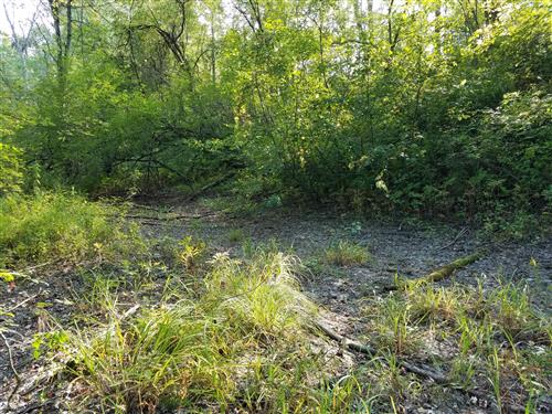
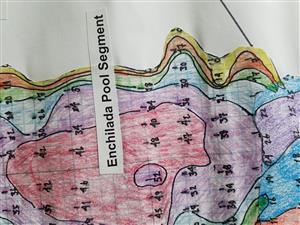
Enchilada Zone: This shows slightly different geography. It is looking back from the end of the Enchilada area (roughly northerly). One can clearly see how flora infiltrates the immersion zone of this pool. As these plants had been observed for a full year, it's safe to assume that different species might choose this area for their life cycles. The depths at this end of the pool were generally shallow and a greater amount of sunlight penetrated the zone.
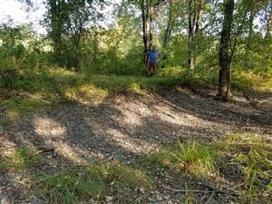
This view shows "Drizzle Cake" zone of the vernal pool. The fallen limb was used as a divider between this pool and "Enchilada." This view is looking southward. To the right and just out of the shot is the dried rivulet later found to be a springtime feed for melting snow from just above the area. There's some evidence to suggest that this is another separate vernal pool, but the time that it exists is so short, no one is sure that any species could adapt to the conditions offered in its geography.
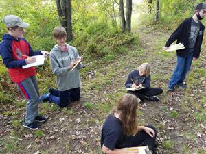
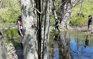
Data Collection: Cartographic teams usually involved two members establishing the transect line, a depth "caller," and a recorder. Work required focus and coordination between members At any given time up to five teams were building and measuring data - then leapfrogging over other teams to establish the next metre's measurements. In any given, two-hour eight complete raw-data transects could be built. This raw data than required lab time to transcribe into drawings. Contour lines would be built around depths of similar value and those lines would then form a map of shallow and deep zones within each of the vernal pool segments. The researchers in the photo to the left are working on transacts at the relatively shallow and narrow Drizzle-Cake Zone of the larger pool.
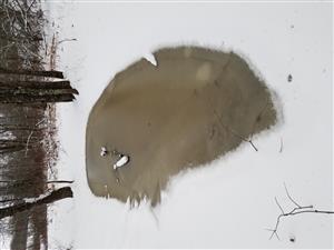
Redundancy is critical to accurate raw data. Even with coordinated teams creating data for transect measures, recording teams along the trail adjacent to the vernal pool repeated measurements to one another to confirm the amounts and ensure accuracy. In this way, lab work could depend on teams producing identical values for each location. A total of five, two-hour visits were required to map out the areas identified. Roughly an equal amount of time was needed by these same teams to transcribe raw data into a refined form of a map. It should be emphasised that at the conclusion of this research, there was NO water in the pool; our work was based on an assumption that the natural cycle of weather and season would restore water to the pools to provide a biologic opportunity for springtime. Several times over the winter the Shackleton Group visited the site (which is adjacent to the Browns River but is never in contact with river flow). The group confirmed that water was, in fact filling the pool. (see picture below, left.)
Wintertime Progress: Several times over the winter the Shackleton Group visited the site (which is adjacent to the Browns River but is never in contact with river flow). The group confirmed that water was, in fact filling the pool. (see picture at left.) This view (posted sideways owing to limitations within the html format) shows the Pot Belly portion.
Transect measurements were made at 0.5 m. x 1 metre increments on all maps.
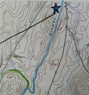
Site location: This closeup of an Army Corp. of Engineers map shows the location of the vernal pool. Note its proximity to the Browns River (though there is never a flow from the river to the pool.) Notice, too that the contour lines immediately beside the pool show the upland direction of the landform behind the pool.
Fairy Shrimp: Scheduling difficulties prevented a return to the pools until the first week of May (when April visits would have been better to see the start of biological processes with flora and fauna. When we were able to return, the number of samples nearly outweighed the group's ability to identify and record each. The next few pictures show the variety of species that were recorded.
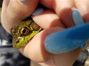
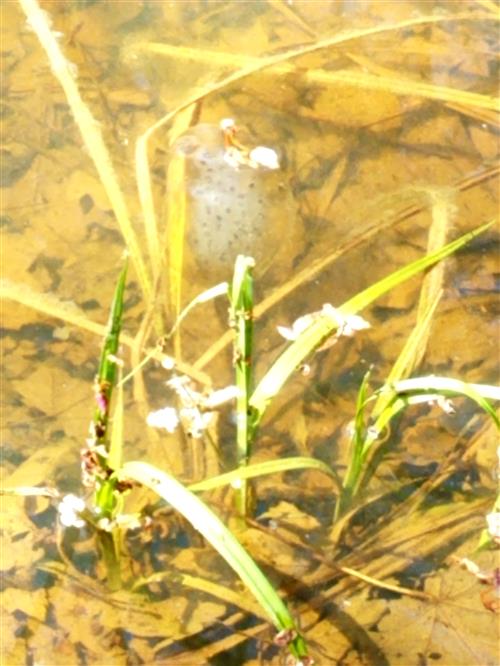
leopard frog: A dozen of these were located around the perimeters of all three zones, although the larger samples seemed to prefer the shallow areas of Enchilada. (This happens to be the same area where two egg masses were located, but whether the two are connected in some significant way can't be established.This image shows the importance of geography to species' needs. Although sideways, the photo shows how frog egg mass attaches to grasses growing below the water level. Sunlight is full and the depth of the water is only 10 centimetres. Sadly, this pool dried up only four days later. It's likely the frog mass became a food source for another species frequenting the vernal pool.
boatman or water penny
These beetle larvae were too small to determine an identification by student researchers, but it's thought that they were either boatmen or water pennies. The beetle sample was not particularly active which boatmen will exhibit, though the shape and hue is not quite typical for water pennies.
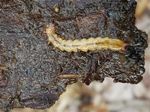
benthic macroinvertebrate (BMI) - caddisfly larvae
Some species are known to live in the adjacent Browns River also adapt to vernal pool lifestyles.(Westford school has had bi-annual assessments of BMIs since 1990 and caddisflies are always a common species found. This sample is difficult to identify, although it's likely to be one of the varieties of caddisflies. The three pairs of proto-legs are clearly seen. However, The colouration of this sample is not the same as what is found in the Browns River.
egg mass found in Enchilada zone
Two of the three egg masses identified were located in the sunlight shallows of the Enchilada zone. Only a week later, the pool was dried up likely making this sample more of a food source for another species than a viable development of amphibians. Sometimes nature makes some brutal decisions.
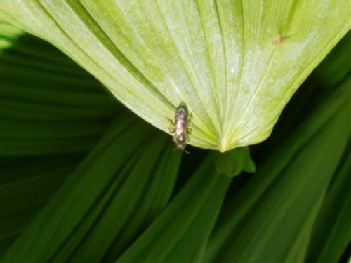
bee on a hosta leaf: small, dark bees seemed to alight on wild hosta plants surrounding the east and south sides of the vernal pool. Hosta was abundant in 5 metres adjacent to the pool areas.
Hosta: This image shows a typical specimen located adjacent to the pool area. It's likely nearly one hundred plants surround the east and south sides of Pot Belly and Enchilada zones.
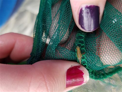
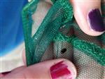
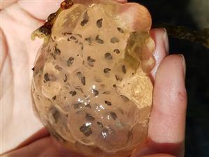
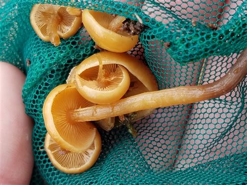
mushrooms were below the pool bank edge in the water. Unfortunately, they were harvested with a sample net before in situ photographs could be taken. Note the fingers on the backside of the net to show size perspective. These were located on the east side of Pot Belly pool.
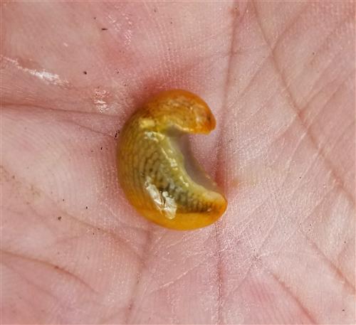
This unknown creature appears to be undeveloped into its early stage. Possibly a frog or salamander species?
What is this animal?
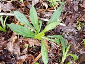
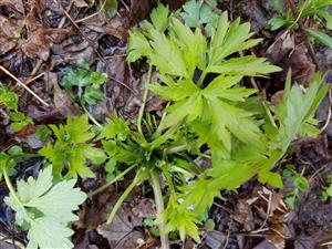
As yet unidentified plant samples were submitted through Inaturalist for ID.
creeping buttercup
hosta
class Magnoliopsida
(iNaturalist ID source)
trillium
Sample Spring Data: As with any research, the quantity of raw data builds toward reliable patterns of temperature, species development, vegetation growth - in effect, all the components that characterise a vernal pool. Using a form developed by Vermont Center for ECOSTUDIES, the following is data collected by six teams during a two-hour pool observation and assessment:
Visit date: 14 May 2021 @ 11.00 AM
vegetation
submerged vegetation - 28% floating vegetation - 0% emergent vegetation - 33% shrubs - 13% trees - 22%
physical parameters descriptors
swampy, muddy (2), lots of shrubs
ice - 0%
Beaufort scale - 1
water level - low
weather - sunny 68 F.
relative humidity 58%
species identifications - fairy shrimp, caddisfly larvae, tadpoles, tadpole eggs masses (3), water skipper beetle, unknown immature amphibian specimen, peepers, hosta, 6 unidentified plant species, multiple tree types.
This spring transition was sudden. Only a week following these field research photographs, the water level dried up, leaving many developing species (no pun intended) high and dry.
It's difficult to imagine that a week following this shot, the entire pool was dried up. It started with a small pool and the rivulet connecting it to the end of this pool (Drizzle Cake) drying up and no longer adding water. Cut off from this tributary, sun and wind took care of the rest.
Developments for 2021-2022: Toward the end of the school year financial assistance from V.A.S.E. facilitated the purchase of a field camera with infrared flash. This unit will be put into the vernal pool area to record mammal and bird species visiting after dark. A HOBO data logger was purchased. It will be placed just above the central area of the vernal pool to provide remote hourly measurements of water temperatures. Currently on back-order is a one-of-a-kind recording device specifically constructed to record outdoor animal sounds while remaining waterproof. These additions, combined with continued identification of flora and fauna species using the Inaturalist app will allow us to begin to detect patterns of species, growth, death, weather and events taking place both with on-site research as well as remote sensing.